Catalogs
A catalog is a browsing surface, for when you have more datasets than a single map should show at once. The dataset list is the page; the map sits beside it and shows whatever the reader switches on.
Choose it when your visitors arrive looking for a dataset rather than looking at the map.
The page
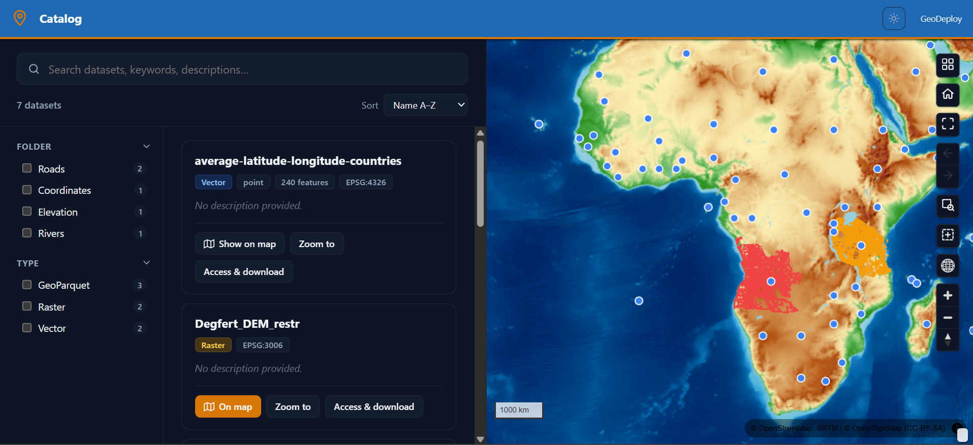
Three regions: a facet rail for narrowing, the results themselves, and the map.
The layer list is off by default here — the facet rail is the browse surface, and a second list of layers beside it would be two answers to the same question. You can switch it back on; it appears floating over the map rather than taking a column, because the horizontal space on a catalog page belongs to the results.
What a result shows
Each dataset card carries what someone deciding whether to use it needs:
- Its name and abstract
- What it is — vector or raster, geometry type, feature count, CRS
- Its licence and attribution
- How to get it — the open-standard endpoints for that layer, ready to paste into QGIS, Python or R
Clicking a card adds the layer to the map; the zoom control on it flies to that dataset's extent. So a reader can go from "what is in here?" to "show me" without leaving the page.
Searching and filtering
- Search runs across names, descriptions and keywords.
- Facets narrow by folder, by type (vector, raster, external) and by licence.
Both act on the result list, and the map follows whatever the reader switches on.
Layout choices
| Option | What it does |
|---|---|
| Datasets listed | This portal's layers, or every public layer on the instance |
| Map side | Right, bottom, or no map at all |
| Map width | How much of the content area the map takes (default half) |
| Facet rail width | How much the rail takes (default a fifth) |
| Results per page | How many cards before paging (default 12) |
Portal or instance-wide
This portal's layers is a curated catalog: you choose what appears. Every public layer turns the portal into a front door for the whole instance — anything marked public shows up without being added to the portal. The second is what you want for an organisation's open-data page; the first for a project's own catalogue.
Only layers marked public are ever listed instance-wide. A private layer is not exposed by switching this on.
No map at all
Setting the map side to none gives a pure dataset index — a list, its facets, and the access links for each entry. Reasonable when the datasets are national or global and a map preview adds nothing.
On phones
The page stacks vertically: filters on top, results below them, map beneath. Nothing is dropped, and the reader can still switch a dataset on and see it.
Catalogs and the machine-readable index
A catalog portal is the human-facing view. The same layers are simultaneously readable by machines through the instance's open-standard endpoints — see Access from other tools.
The two stay in step because they are the same data, not two exports of it: mark a layer public and it appears in both.
When to choose something else
- One map is the point, and the layer list is enough → Web maps
- The datasets tell a story in order → Story maps
- Readers want summaries and filters rather than the datasets themselves → Dashboards