Web maps
A web map is the default experience and the right one when the map itself is the point: a full-screen map with a layer list beside it, and everything else arranged around that.
If you are not sure which experience you want, start here. Switching later keeps your layers, your styling and your branding — only the arrangement changes.
The page
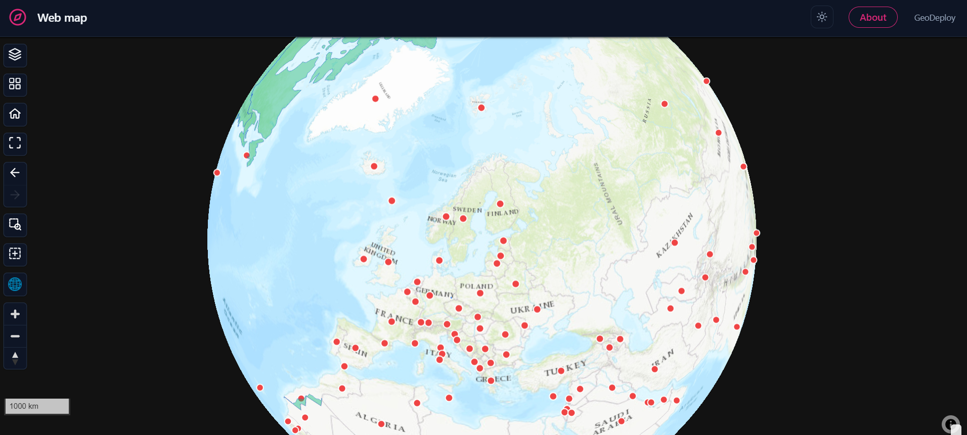
The layer list is the main furniture. Each layer shows a swatch, its name, an eye to hide it, a zoom-to-extent button, and — where the symbology has classes — its legend, which expands under the row. Layers can be dragged to reorder; the top of the list draws on top of the map.
Folders group layers, and a folder can be collapsed, hidden as a unit, or zoomed to as a unit. Useful once a portal carries more than a handful of layers.
A search box appears above the list once there are enough layers to be worth filtering.
Layout choices
| Option | What it does |
|---|---|
| Side | Layer list on the left or the right |
| Mode | Docked takes a column beside the map; floating overlays it, which gives the map the full width |
| Start collapsed | Opens with the list closed — one tap on the on-map toggle opens it |
| Width | How wide the docked column is |
| Controls corner | Which corner the map's control cluster sits in |
| Header | A full bar, or a minimal treatment |
Panels can each be switched on or off: the layer list, the legend, the basemap switcher and the About page.
Floating vs docked
A docked list is easier to scan and costs the map a column. A floating one gives the map the whole page and asks the visitor to open the list when they want it. For a portal with two or three layers, floating and collapsed is usually the better default.
What visitors get on the map
Every published portal — not only a web map — carries:
- Basemap switcher, and a 2D/3D globe toggle
- Home, which returns to the view you pinned when publishing, and zoom to all layers
- Previous / next extent — the navigation history every desktop GIS has, for stepping back after a zoom-to
- Click to identify — attributes for the feature under the cursor, including layers served from files rather than a database
- Draw a box to download — see below
Pinning the starting view
Position the map how you want visitors to arrive, then capture it in the editor. That view is what Home returns to, and what the portal opens on. Pitch and bearing are captured too, so a portal can open tilted.
Download by area
A visitor can draw a box and download just that area, choosing a format per layer. The clip runs on the server and is prepared in the background, so a large selection does not block the page.
About panel
A web map can carry an About page — a written description of what the portal is, who made it and what the data means. It is off in the other experiences by default, because a catalog puts that information on each dataset card and a dashboard's widgets name their own data.
On phones
The layer list becomes a drawer that starts closed so the map is visible, and the map controls stay reachable. Nothing is removed.
When to choose something else
- The story is a narrative with a beginning and an end → Story maps
- You have more datasets than one map should show at once → Catalogs
- The question is about the data rather than the geography → Dashboards